Skip to content
Panama-California Exposition Digital Archive
  • Home
  • People
  • Features
    • Maps by Date
    • Groundbreaking
    • Art and the Fair
    • Audio & Video
    • Sheet Music & Lyrics
    • Pt. Loma Road Race
  • About
    • …The Exposition
    • …The Digital Archive
    • …Archive Staff, Donors and Contributors
  • Search

Maps

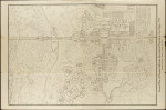
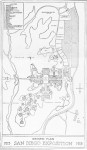
Arranged in chronological order, these ground plans and bird’s-eye views show the concept for the Exposition during its evolution. To view metadata and details, click on the caption, not on the image:

Olmsted Plan, 1911
Olmsted Plan, 1911
1911 Birdseye View
SD Union 1911
Townsend Brown, 1912
1912 Map
Allen, 1912
Architectural Review 1914
1914 San Diego Union
Wells Fargo, 1915?
Model Farm 1915
1915 Guidebook Map
1915 Pictorial Publishing Co.
1916 Guidebook Map
E.E. Knight, 1916
All Contents © 2025 by C100
Responsive build by Phreesurf.
Orig. build/design by Summit Web Services & Nullvariable.